Mali
The Gourma mesoscale site (Mali) is part of the mesoscale observation network of the AMMA-CATCH observatory. Various instruments have been deployed there since 1984, in order to monitor the water cycle and vegetation dynamics. Their distribution is shown on the map below [observation period : 2004-2011]. An interactive map of the instruments at different scales is available on the AMMA-CATCH database portal.
Its characteristics are as follows :
Since 2012 the monitoring of this site is on standby for security reasons.
In 2021, only rainfall and vegetation measurements will continue in the vicinity of the town of Hombori, in what used to be the AMMA-CATCH super-site. The observations are conditional on the evolution of the security situation.
» Mali : Map of instruments set up on the Gourma mesosite (2004-2011)
» Mali : Map of instruments set up on the Gourma mesosite/ Hombori supersite (2004-2011)
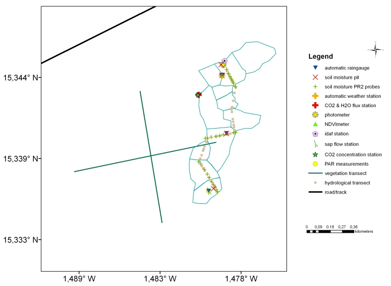
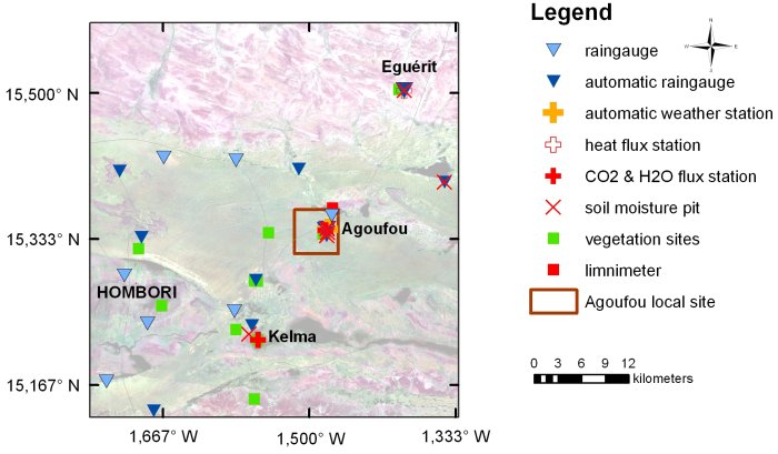
» Mali : Map of instruments set up on the Gourma mesosite/ Agoufou Intensive site (2004-2011)
Mali mesosite : Map of the Gourma mesosite (2004-2011)
Since 2012 the monitoring of this site is on standby for security reasons.
See below the instruments deployed (2004-2011 period) on the mesosite.
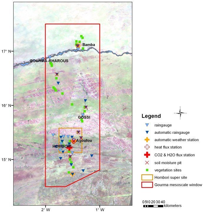
Mali mesosite : Map of the Hombori supersite (2004-2011)
Since 2012 the monitoring of this site is on standby for security reasons.
See below the instruments deployed (2004-2011 period) on the supersite.
Mali mesosite : Map of the Wankama Intensive site (2004-2011)
Since 2012 the monitoring of this site is on standby for security reasons.
See below the instruments deployed (2004-2011 period) on the intensive local site.